
Advanced Aerial Surveys and Imaging Services in Bangor, Maine
Elevated Intelligence for Maine
Bangor Helicopter Charters delivers comprehensive aerial survey capabilities across Maine, leveraging the helicopter's unmatched low-flying and hovering precision. We facilitate advanced operations including magnetometer, electromagnetic, and LiDAR surveys, alongside detailed GIS mapping. Furthermore, our expertise extends to specialized aerial filming services, providing access to cutting-edge cinematography and photography platforms, or practical solutions such as door-off configurations for handheld projects. We offer robust aerial data acquisition and visual documentation solutions tailored to your project’s exacting specifications across the diverse Maine landscape.
Aerial
Surveys
LiDAR, GIS Maps, FLIR, HD Video & More
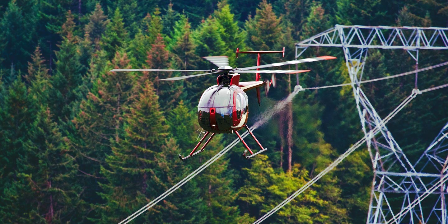
For critical infrastructure inspections, including pipeline surveys, Right-of-Way (ROW) assessments, and comprehensive transmission line patrols, Bangor Helicopter Charters provisions the precise aircraft and specialized equipment required. We facilitate efficient and accurate project execution, ensuring your operational requirements are met with professionalism and adherence to safety protocols throughout Maine.
High Tech Results
The Top Pilots in Maine, Today's Technology... Maximum Results.
Call 1-866-826-4826 Now!
Bangor Helicopter Charters provides the tools needed to complete your land surveys, utilizing the right equipment to provide the aerial photos that are often needed.
Effective aerial surveys streamline critical operations such as Right-of-Way (ROW) and site inspections, precise topographical data acquisition, and high-definition imaging for commercial projects. Helicopter-based surveys offer unparalleled versatility for detailed examination of Maine's diverse terrain, from detecting pipeline anomalies and transmission line issues to comprehensive property videography and photography. Bangor Helicopter Charters specializes in developing bespoke photographic and remote sensing operations, meticulously engineered to optimize both technical precision and financial efficiency, ensuring superior results for your specific objectives.
The distinct aerodynamic capabilities of helicopters make them the optimal platform for aerial surveying. Unlike fixed-wing aircraft, which are generally restricted by FAA regulations to a minimum of 1,000 feet above obstacles, helicopters can operate at significantly lower altitudes and reduced airspeeds. This unique maneuverability facilitates precise data acquisition and detailed visual inspections. Furthermore, helicopters provide unparalleled access to examine complex, hazardous, or otherwise inaccessible areas, offering engineers and surveyors critical perspectives unattainable through other means.
There is no better way to conduct your visual survey, animal population counts, soil drainage analysis, ROW inspections, pipeline and transmission line inspections, and geographical surveys.

LiDAR Imaging
Light Detection and Ranging, or LiDAR, is a remote sensing method used to examine and measure Maine topography as well as objects, like vegetation, upon it.

Infrared Imaging
Thermographic IR cameras are used to detect radiation in the long-infrared range of the electromagnetic spectrum and produce images of that radiation, called thermograms.

HD Video Gimbal Capture
Modern HD and 4K cameras can be mounted to helicopters, using the proper STCs, with a gimbal to stabilize photos & videos for detailed results.
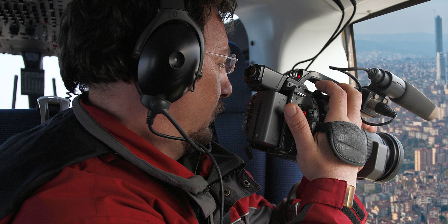
Precision Aerial Cinematography and Visual Data Capture
For expert camera work in the Bangor Sky
Get a Fast, free QuoteBangor Aerial Cinematography
Bangor Helicopter Charters provides access to comprehensive resources for professional-grade aerial cinematography across Maine. Our network facilitates custom shoots utilizing advanced technology, including industry-standard gyro-stabilized camera mounts such as Tyler Mounts, Wesscam, Cineflex, Pictorvision, and SpaceCam. We also provision specialty cameras like Cineflex HD, RED Epic, and Arri Alexa, alongside cutting-edge 3D and experimental camera systems. We support all facets of your production, from air-to-air to ground-to-air perspectives. Collaboration with your aerial Directors of Photography and directors ensures precise visual results. Specializing in helicopter services for both still and motion photography, Bangor Helicopter Charters is equipped for virtually every media-related operation in Maine, encompassing feature films, television productions, documentaries, promotional videos, commercials, aerial props, disaster relief media support for networks, and coverage of historical or major sporting events. We ensure the availability of diverse helicopter platforms to meet your specific creative and technical demands.
Call Us Today at 1-866-826-4826 for a Free Quote
Contact Us
Aerial Photos
Hand-held or Mounted OpTions in Bangor
We will help you get the right equipment for your aerial photography project! Call 1-866-826-4826 today to get a fast, free quote.
The Most Options for Photography
Maine's diverse and compelling landscapes are optimally documented through aerial photography. Bangor Helicopter Charters specializes in provisioning helicopter charters engineered to achieve your precise visual objectives. We provide the operational flexibility to capture intricate details and expansive vistas from an elevated perspective. Our services offer cost-effective photographic solutions throughout Maine, tailored to professional requirements. Many helicopters can be configured with door-off options for handheld projects, and we also facilitate access to advanced gyro-stabilized camera mounts, ensuring superior stability and image quality for demanding aerial capture needs.
Superior Service
Every one of our customers gets a dedicated helicopter expert to assist with flight plans, tech loadouts, production logistics, project schedules, and other demands.
Over 500 Aircraft
Our network of direct air partners extends well beyond Bangor, Maine. This allows us to offer a wide range of solutions for even the most sophisticated projects.
The Best Equipment
From high-tech sensors like LiDAR, FLIR, and GIS to HD cameras and movie production gimbals, we're here to make your job as easy as possible.


